
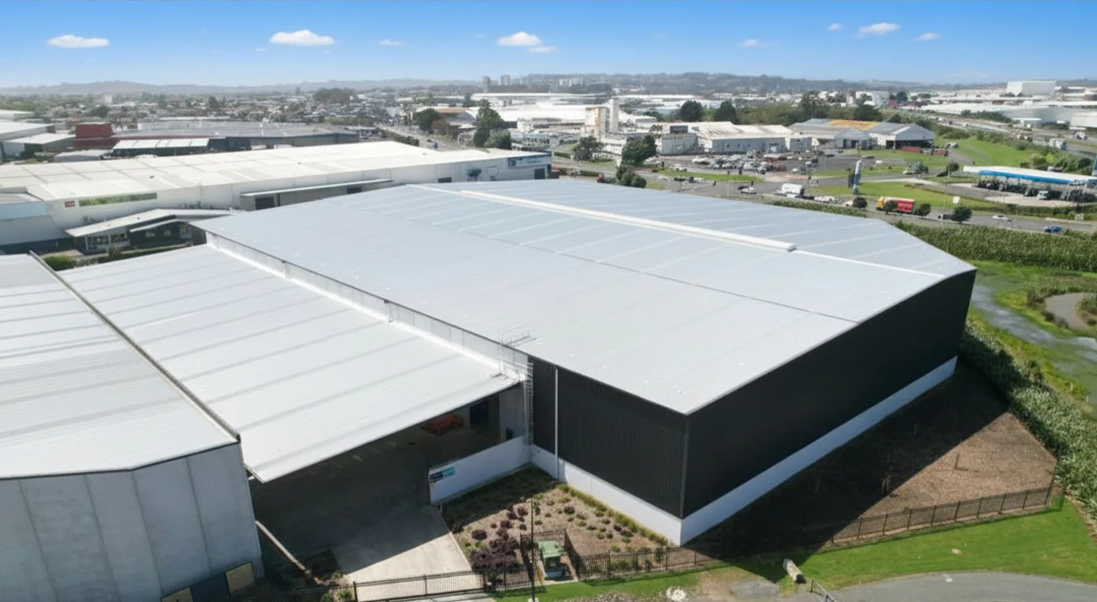
Drone Roof Inspection
Plan a Lakewood Drone Roof Survey
A drone can capture a broad view of a roof without placing a technician on every surface, but images alone do not establish the roof’s condition. For a Lakewood, CO commercial property, we plan the flight around site access, airspace, weather, people and the question the owner needs answered. Images can help locate debris, ponding patterns, displaced components or areas for closer review. The report identifies which observations are visible from above and where a hands-on inspection or test is still required.
Scale makes image organization important. Colorado Mills is a 1.4-million-square-foot regional mall, while Denver West Village is a separate retail center. Mall floor area does not set a roof dimension; we measure the selected roof sections for the flight plan. For each assignment, we divide the property into identifiable roof sections and label imagery against the owner’s plan instead of delivering an unindexed image folder.
What must be planned before the aircraft launches?
We confirm property authorization, takeoff and landing area, flight boundaries, building hours, pedestrian routes, nearby obstacles and any site-specific security rules. A contact should identify rooftop equipment, tenant activity, loading lanes and areas that must remain clear. Flight planning also considers weather, visibility, wind and the applicable operating requirements. If a safe or authorized flight cannot be completed, we explain the limitation and propose another inspection method.
We also set a data-handling plan before flight. The owner identifies who may receive imagery, how files should be named, and whether security-sensitive equipment or tenant areas must be excluded. Image resolution should match the task: a broad asset map does not need the same close capture as a suspected puncture. These choices keep the deliverable useful and limit unnecessary capture of unrelated portions of an occupied property.
Lakewood’s business hubs include dense retail, office, civic, healthcare and institutional uses. Near Union Boulevard and Federal Center, access protocols may involve government or medical property contacts. We confirm the owner’s permission and any applicable restrictions before collecting imagery. Drone capture is an inspection tool, not an automatic substitute for a roof walk, and it does not grant access where the property has not authorized it.
What can aerial imagery show clearly?
High-resolution images can help map roof geometry, membrane discoloration, visible punctures, debris accumulation, standing water after suitable weather, displaced metal and the locations of rooftop units. Overlapping views can support a roof plan and help compare areas that look different. A thermal payload, if separately specified and conditions support it, may show temperature patterns but does not by itself prove moisture. Each image finding is described with its location and confidence limits.
Surface color can change with age, shadows, water, repairs or materials. A dark area is not automatically a leak, and a reflective spot is not a confirmed defect. We compare the imagery with the roof plan, prior reports and field observations. If a suspected condition requires touching a seam, checking an attachment or determining insulation moisture, a hands-on commercial roof inspection or moisture testing can answer the question more directly.
How are flight results organized for facilities staff?
The image package should make a roof area easy to identify. We use building and section labels, capture date, flight notes, annotated overview images and a findings list that separates visible observations from recommended verification. Where useful, a location pin or section callout connects an image to a repair work order. The owner receives a concise index, not just a large set of files requiring staff to locate each concern manually.
Lakewood reports about 47 million square feet of office, retail and commercial floor area across its hubs; the flight plan uses measured roof dimensions for the selected building. We define the actual buildings, accessible launch point, image resolution and deliverable before mobilization. A capital planning review can connect the mapped findings with roof age and budget decisions, while maintenance records can track repeated observations in later seasons.
When is a roof walk still necessary?
A technician must approach the roof when the assignment requires tactile inspection, material sampling, drain clearing, seam probing, attachment checks or a repair. Flight images may miss conditions hidden by equipment, parapets, snow, deep shadow or low contrast. Close detail work may require a safe access route, fall protection and an escort. The image package marks blind spots as uninspected and schedules close-range follow-up where needed.
For drone planning, the engineer checks the approved snow criteria while the flight maps visible surface conditions and access limits. If unusual deflection or movement is reported, the area should be assessed by appropriate professionals. Because hail is a near-term Lakewood hazard, a flight can map apparent impact areas for a follow-up surface inspection and manufacturer-specific evaluation. A broader storm assessment can be added when the owner needs more than image capture.
What information improves the next inspection?
Share the roof plan, building names, previous reports, flight restrictions, equipment map and the decision the imagery should support. We will confirm access, select the image areas and define whether the work includes visual annotation, hands-on verification or follow-up testing. After delivery, facilities staff can identify a repair or add the images to the building record.
If imagery will be used by a roofing consultant or facility contractor, we agree on file format and coordinate labels before capture. That saves time when annotations are transferred into a work order or asset system. Any proposed repair location should be verified on site before tools or materials are ordered, especially where a parapet, equipment bank or roof level obscures the image.
Repeat flights are most useful when they use consistent labels, viewpoints and capture timing. A baseline image set can make changes easier to locate after maintenance or a weather event, but it should be compared with current field observations. We can help the owner define a repeat interval based on roof condition and operational needs rather than treating routine capture as proof that no defects exist.
Related Roofing Work
Questions About Drone Roof Inspection
Can a drone inspection replace a technician on the roof?
It can reduce the need for initial roof access when the question is visual, but it cannot touch seams, test insulation, clear drains or perform repairs. The report identifies where a roof walk remains necessary.
Can drone images detect wet insulation?
Standard images cannot confirm moisture inside the assembly. Thermal patterns may guide investigation under suitable conditions, but core cuts or other approved testing are needed to verify concealed moisture.
Do you need permission to fly over the property?
We confirm the owner’s authorization and applicable flight requirements before scheduling. Site security, nearby operations and weather can change the available flight area or timing.
What happens if the roof is partly hidden?
We note obstructions and blind areas in the image index and recommend a safe alternate viewpoint or hands-on inspection. The report does not infer conditions beneath an obstruction.
Can drone photos be used to price repairs?
They can help locate and scope visible work, but close detail, material compatibility and concealed conditions may require a site visit before a repair estimate is final.
Talk with our Lakewood roof team
Send a roof plan, property contact and the question you need the imagery to answer. We will confirm flight access and define the image and field-verification scope.